All Hazards Emergency Management Software
Crisis Track offers the most powerful emergency management solution on the market today.
- Incident action plans
- Resource management and requests
- Situational reporting
- Search and rescue operations management
- HazMat spill cost recovery
- Evacuation survey and reentry permitting
- Includes all functionality of the Damage Assessment tier and the Disaster Management tier
All Hazards Emergency management is complete with full incident management capabilities.


Copyright: tonsnoei / 123RF Stock Photo
Situation Reporting
Crisis Track makes emergency management situation reporting easy and standardized.
- Streamline SITREPs by auto-populating information from various Emergency Support Function groups
- Easily configure the report to meet your organization's specific needs or use one of the Crisis Track SITREP templates.
- Setup SITREP notifications by email for each operational period
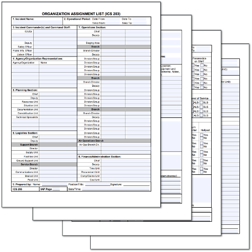
Incident Action Planning
Crisis Track helps you quickly create your incident action plan from either the EOC or from your phone.
- Capture IAP data from your mobile device without needing internet connectivity
- Manage resources and identify resource needs
- Export and store IAPs for each operational period
- Tailor the IAP to collect only the information needed for a specific type of incident
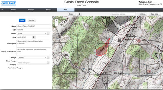
SAR Incident Management
Crisis Track helps search teams plan, manage and document search activities for more efficient, more accurate, and better documented search operations.
- Use local GIS, topographic, and aerial photographic maps to efficiently plan search areas and assign mission tasks
- Use mobile devices in the field to locate positions within search area and capture search data
- See all search team locations and clues in real time
- Automatically generate and save standard ICS and State SAR forms like ICS 204 and ICS 214.
HAZMAT / Spill Response Incident Management
Crisis Track helps you quickly analyze, track and document the events and costs associated with HAZMAT Response incidents as well as prepare documentation needed for reporting and cost recovery.
- Use the mobile app to quickly identify and organize responders reporting at the scene
- Use local GIS, USGS topographic maps, and aerial photography to quickly analyze the potential effects surrounding the incident
- Provide real-time incident maps for local officials and public situational awareness
- Document total operation costs through the software's automated resource time tracking

Copyright: sarotepruksachat / 123RF Stock Photo
Copyright: macmedic892 / 123RF Stock Photo
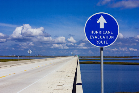
Evacuation and Reentry Management
Crisis Track uses your organization's infrastructure location and property ownership data to help you plan evacuation surveys and issue reentry permits.
- Plan door-to-door evacuation surveys
- Approve reentry permit applications using GIS and tax data
- Issue incident specific reentry permits based on the area of concern